Colima Volcano
Updated: Apr 20, 2024 08:19 GMT -
Stratovolcano 3850 m / 12,631 ft
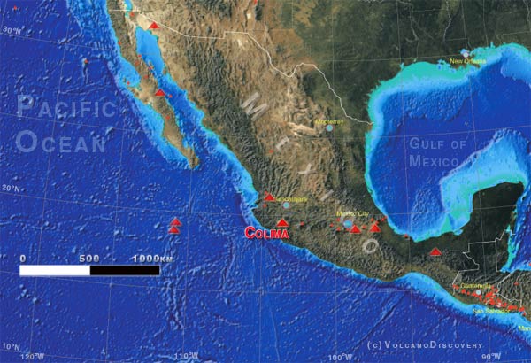
Western Mexico, 19.51°N / -103.62°W
Current status: normal or dormant (1 out of 5)
Western Mexico, 19.51°N / -103.62°W
Current status: normal or dormant (1 out of 5)
Last update: 18 Oct 2023 (Smithsonian / USGS Weekly Volcanic Activity Report)
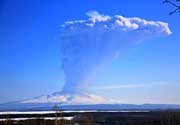
Strong explosion at Colima volcano in Feb 2015
Colima volcano is one of the most active volcanoes in North America and one of the potentially most dangerous ones. It has had more than 30 periods of eruptions since 1585, including several significant eruptions in the late 1990s. Scientific monitoring of the volcano began 20 years ago.
[smaller] [larger]
Colima volcano eruptions: 1519, 1560, 1576, 1585, 1590, 1602(?), 1606, 1611-1613, 1622, 1690, 1711, 1743(?), 1744, 1749(?),1769, 1770, 1771, 1780, 1794, 1795, 1804, 1806-1809, 1818, 1819, 1866, 1869, 1870-71, 1872-73, 1874, 1875-78, 1879-80, 1880-81, 1882-84, 1885-1886, 1887, 1889-90, 1890, 1891-92, 1893-1902, 1903, 1904-1906, 1908-09, 1913, 1926-1931(?), 1941(?), 1957-1960, 1961-62, 1963-70, 1973(?), 1975-76, 1977-1982, 1983(?), 1985-86, 1987, 1988(?), 1991, 1994, 1997-2011, 2013-ongoing
Latest nearby earthquakes
| Time | Mag. / Depth | Distance / Location | |||
Background
The Colima volcanic complex is the most prominent volcanic center of the western Mexican Volcanic Belt. It consists of two southward-younging volcanoes, Nevado de Colima (the 4320 m high point of the complex) on the north and the 3850-m-high historically active Volcán de Colima at the south.A group of cinder cones of probable late-Pleistocene age is located on the floor of the Colima graben west and east of the Colima complex. Volcán de Colima (also known as Volcán Fuego) is a youthful stratovolcano constructed within a 5-km-wide caldera, breached to the south, that has been the source of large debris avalanches. Major slope failures have occurred repeatedly from both the Nevado and Colima cones, and have produced a thick apron of debris-avalanche deposits on three sides of the complex. Frequent historical eruptions date back to the 16th century. Occasional major explosive eruptions (most recently in 1913) have destroyed the summit and left a deep, steep-sided crater that was slowly refilled and then overtopped by lava dome growth.
Colima Volcano Photos
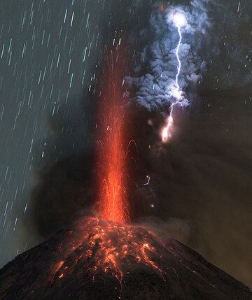
Strong vulcanian eruption at Colima volcano with volcanic lightning (Photo: Tom Pfeiffer)
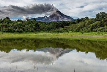
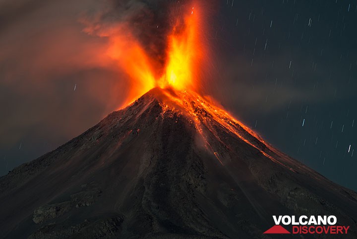
Steaming Colima volcano in Mexico with an active lava flow, mirrored in a small lake. (Photo: Tom Pfeiffer)
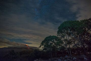
Night-time view of Colima volcano with an active lava flow (July 2015). (Photo: Tom Pfeiffer)
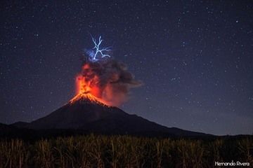
Vulcanian eruption at Colima volcano with lightning on 26 Jan 2017 (Photo: Hernando Rivera)
Latest satellite images

Colima Volcano Tours
Mexico
Colima Volcano Special
5 days expedition to observe and photograph Colima volcano, Mexico
5 days / 4 nights - Easy
Price open
Price open
Custom and group dates
on request on custom dates