Contact | RSS | EN | DE | EL | ES | FR | IT | RU

Sorikmarapi Volcano

Updated: Apr 19, 2024 23:15 GMT -
Stratovolcano 2145 m (7,037 ft)
Sumatra (Indonesia), 0.68°N / 99.54°E
Current status: normal or dormant (1 out of 5)
Last update: 3 Oct 2022 (fluctuating activity continues)

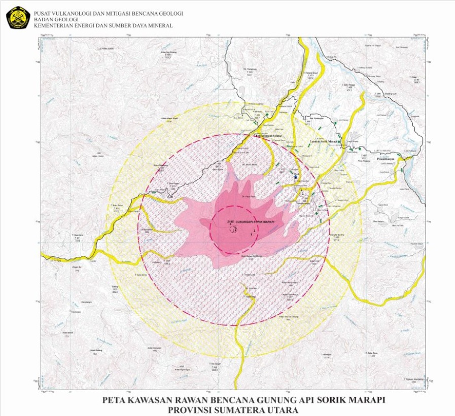
Sorikmarapi is a forested stratovolcano with a 600-m-wide summit crater containing a crater lake and substantial sulfur deposits.

[smaller] [larger]
Typical eruption style: Phreatic explosions. Strong hydrothermal activity. Strong fumaroles, crater lake.
Sorikmarapi volcano eruptions: 1829(?), 1866(?), 1879, 1888(?), 1892, 1893, 1917, 1970, 1986, 1996(?)

Latest nearby earthquakes

No recent earthquakes
TimeMag. / DepthDistance / Location

Background

A smaller parasitic crater (Danau Merah) on the upper SE flank also contains a crater lake; these two craters and a series of smaller explosion pits occur along a NW-SE line. Several solfatara fields are located on the eastern flank. Phreatic eruptions have occurred from summit and flank vents during the 19th and 20th centuries.

---
Source: GVP, Smithsonian Institute

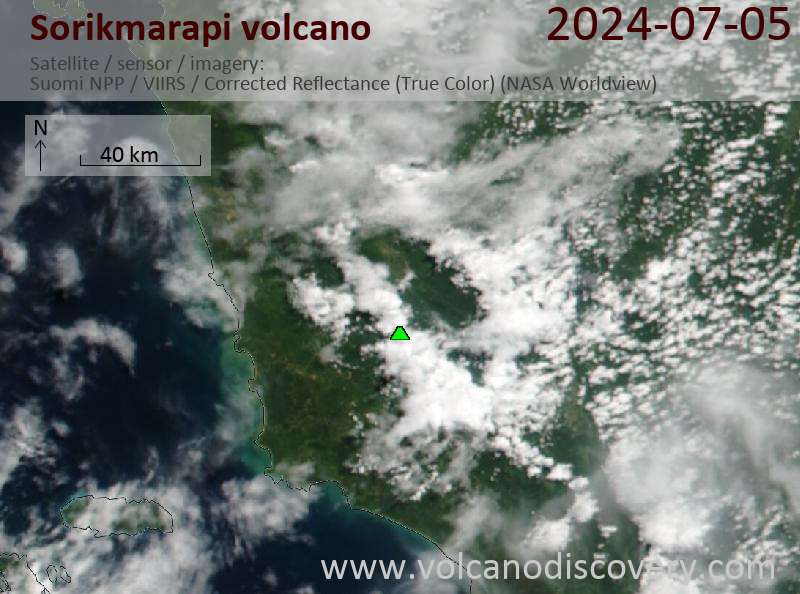
Latest satellite images

Sorikmarapi satellite image sat1Sorikmarapi satellite image sat2

Mon, 3 Oct 2022, 03:31

Sorikmarapi volcano (Sumatra, Indonesia): fluctuating activity continues

Sorikmarapi volcano hazard map (image: PVMBG)
The activity of the volcano continues at fluctuating values since January 2022. ... Read all
Sat, 31 Dec 2011, 11:05

Sorikmarapi volcano (Sumatra, Indonesia) activity update: alert level back to normal

Increased seismicity from Sorik Marapi was detected during 1-12 December and white plumes rose 40-50 m above the summit. CVGHM raised the Alert Level on 12 December from 1 to 2 (on a scale of 1-4) and back to 1 (normal) on 30 December 2011. ... Read all

On this page:

Try our free app!
Volcanoes & Earthquakes - new app for Android
Android | iOS version

More on VolcanoDiscovery

Why is there advertising on this site?

Support us - Help us upgrade our services!

We truly love working to bring you the latest volcano and earthquake data from around the world. Maintaining our website and our free apps does require, however, considerable time and resources.
We need financing to increase hard- and software capacity as well as support our editor team. We're aiming to achieve uninterrupted service wherever an earthquake or volcano eruption unfolds, and your donations can make it happen! Every donation will be highly appreciated. If you find the information useful and would like to support our team in integrating further features, write great content, and in upgrading our soft- and hardware, please make a donation (PayPal or Online credit card payment).

Planned features:Thanks to your past donations, these features have been added recently:
Download and Upgrade the Volcanoes & Earthquakes app to get one of the fastest seismic and volcano alerts online:
Android | IOS
Thank you!
Sources: VolcanoDiscovery / VolcanoAdventures and other sources as noted.
Use of material: Most text and images on our websites are owned by us. Re-use is generally not permitted without authorization. Contact us for licensing rights.
Volcanoes & Earthquakes
VolcanoDiscovery Home
Volcanoes | Earthquakes | Photos | Volcano News | App
Adventure & Study Travel
Tours to Volcanoes and Volcanic Areas: walking tours, photo tours, study tours
Tours & Dates | FAQ | About us
Get our newsletter!
Company info
Contact | Legal info | Terms & conditions
Follow us
Follow us on facebook Follow us on Instagram Follow us on Twitter Visit our Youtube channel
EN | DE | EL | ES | FR | IT | RU
VolcanoDiscovery GmbH, Germany, Reg. nr.: HRB 103744, EU Tax Id: DE 297 465 123 owned and created by
Dr. Tom Pfeiffer, volcanologist, volcano photographer, tour organizer member of
IAVCEI
IAVCEI
Vulkanologische Gesellschaft
Volcanological Society
Ecotourism Greece
Ecotourism Greece
RUV insurance
Insured by R+V
VolcanoDiscovery © 2004- All Rights Reserved | Privacy - Cookie Settings